





Target audience: the advanced training course is available to individuals who hold (or are currently pursuing) a higher or secondary vocational education in the relevant field, or who have completed professional retraining in the corresponding area.
Studying methods: lecture, seminar, independent homework, case study, problem solving, calculations, graphing, group discussion, exercises, and watching videos.
After of course, participants will be: to improve professional competencies as reflected in practical abilities:
- evaluate the effectiveness and quality of the geosteering methods used;
- analyse the accuracy of drilling commands issued by the geological team;
- monitor the telemetry process to better control well construction and reduce non‑productive time (NPT);
- apply acquired knowledge to improve geological support;
- perform rapid assessment of the telemetry station and directional drilling unit performance, focusing on the quality of logging, imaging, and inclinometry data in real time;
- enhance competency in key areas such as data density, north corrections (grid‑to‑true north adjustments), log interpretation, and corrections applied to each logging method.
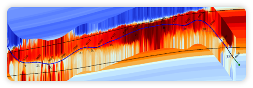
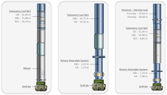
About course: enhancement of professional competencies for specialists in the field of geosteering, M/LWD technologies (telemetry, inclinometry, logging, and imaging), geological support and evaluation of horizontal well drilling efficiency, interpretation of well logging while drilling (LWD), construction of geosteering models, and application of reactive and proactive geosteering methods.